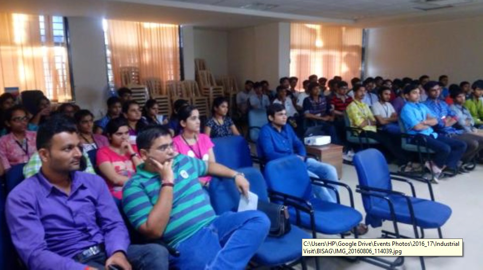
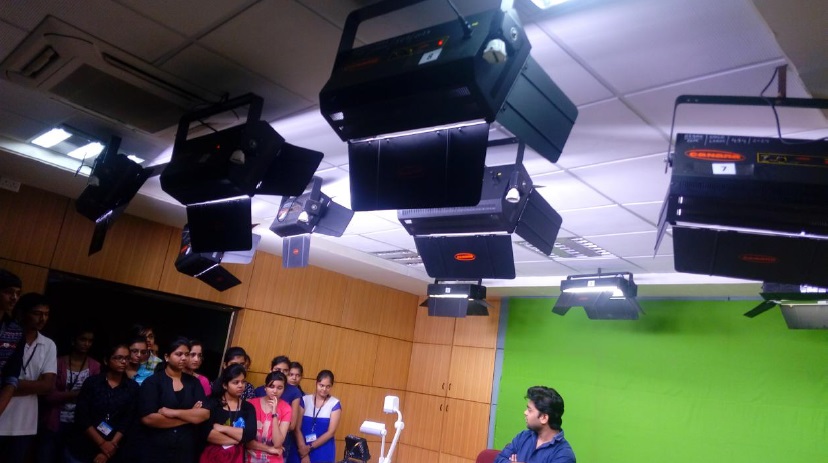
Objectives: " To enhance knowledge of students " To bring awareness of government organization functions ? To know working role of a person in industry ABOUT BISAG : BISAG, formerly known as Remote Sensing and Communication Centre (RESECO), has been renamed after the great Indian Mathematician of the 12th century, Bhaskaracharya. BISAG is a State level nodal agency to facilitate the use of spatial and geo-spatial technologies for the planning and developmental activities pertaining to Agriculture, Land and Water Resource Management, Wasteland/Watershed Development, Forestry, Disaster Management, Infrastructure and Education. The Institute started its operations in April 1997 and was renamed as Bhaskaracharya Institute for Space Applications and Geo-informatics in December 2003. BISAG PROFILE: BISAG provides specialized services and solutions in implementing map-based Geospatial Information Systems. BISAG undertakes all services for the entire process of implementing an enterprise level GIS system. These services include GIS database design and development, map creation/updation and finishing, data migration/conversion and format translation, software development and customization, systems integration and technical consulting. BISAG also provides complete GIS solutions, which bundle hardware, and software with GIS systems development services. BISAG also offers leading-edge Mapping - GIS solutions for disaster management and specialized needs of Public Safety agencies like police, fire and ambulance services. Additionally, a full complement of e-governance solutions is also offered, to address varying GIS and MIS needs of governments and Municipal Corporation. Summary of visit: We arrived at BISAG at 11:00 AM. After that we gathered at BISAG front gate and visited various departments of BISAG. At first we went to the Academy of Geo-informaics for sustainable development, where the students were informed of satellite mapping of earth & how the satellite mapping categorized the different areas on earth like water area, hill station, open land etc. Next we went to official video broadcasting from BISAG for chair persons of Gujarat Government. Mr. Kamlesh sir explains about the GIS system and how GIS system work. He also explain about the different project work which is already done by their industry and free student training in his industry. He also gave a good presentation on mapping system. Conclusion: It was a Wonderful experience for all students as well for staff. Every student was very cooperative to each-other as well to the faculties. Students were acquainted of Geo-informatics & information broadcasting in BISAG. We are very much thankful to Dr. Himanshu Soni, Principal of G H Patel College of Engineering & Technology and Prof. Nikhil Gondaliya, Head of Information Technology Engineering Department for giving their valuable support. We are also very much thankful to staff of BISAG for their co-operation during the visit.
Department: Information Technology